

AgTech Drone Market, ROI and Precision Agriculture Systems (2026)
(Deep Analysis – Data, ROI & Technology)
— Analysis by Gürkan Bal
Founder & Editor | UAV Intelligence
🌾 Introduction: From Farming to Data-Driven Agriculture
Agriculture is no longer based on intuition.
With the integration of drone technology, farming has evolved into a data-driven, precision-managed system.
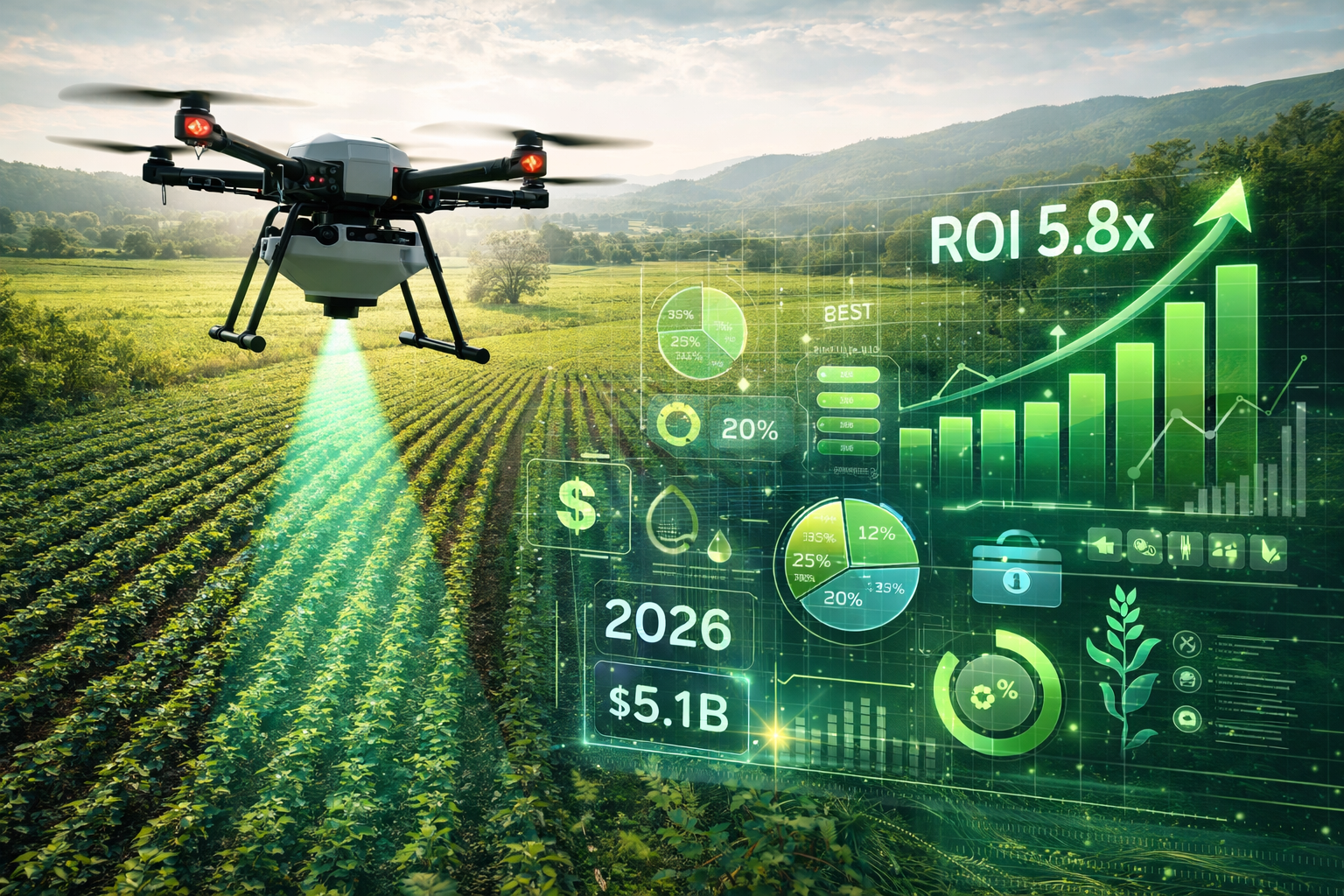
Today, agricultural drones are used for:
- crop spraying and fertilization
- yield mapping and forecasting
- disease detection
- irrigation optimization
- soil and vegetation analysis
👉 Drones are no longer tools in agriculture—
they are production management systems.
📊 Global Market Size and Growth Trends
Agricultural Drone Market (2026)
- Market Size: $9.2 Billion
- Projected Growth (2030): $22.5 Billion
- CAGR: 18.7%
Precision Agriculture Market
- Market Size (2026): $13.8 Billion
- Drone Contribution: ~30%
Drone Seeding & Reforestation Market
- Market Size (2026): $2.1 Billion
- Growth Rate (CAGR): 24.5%
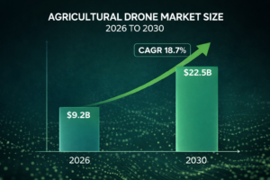
👉 Agriculture represents one of the fastest-growing segments in the global drone economy.
🔬 Core Technologies and Sensor Systems
NDVI (Normalized Difference Vegetation Index)

NDVI enables farmers to monitor plant health based on light reflection.
- Early disease detection
- Water stress identification
- Nutrient deficiency analysis
- Yield prediction
👉 Problems are detected before they become visible.
Sensor Ecosystem
| Sensor Type | Function |
| Multispectral | Crop health, NDVI |
| Hyperspectral | Chemical and soil analysis |
| Thermal | Irrigation and water stress |
| LiDAR | Terrain mapping, biomass calculation |
Variable Rate Technology (VRT)

VRT allows drones to apply different inputs across different zones:
- targeted spraying
- optimized fertilization
- efficient irrigation
👉 Result: 30–50% reduction in chemical usage
🚜 Core Agricultural Drone Applications
Precision Spraying and Fertilization
Drone-based application enables:
- targeted treatment
- faster operations
- reduced chemical usage
Efficiency Gains:
- Chemical savings: 30–50%
- Water savings: 40–60%
- Labor reduction: up to 80%
Drone Seeding and Planting
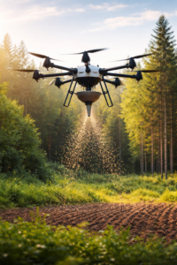
Drone seeding enables:
- access to hard-to-reach areas
- rapid reforestation
- optimized planting density
Performance:
- Cost reduction: up to 80%
- Coverage: 40+ hectares per day
Yield Mapping and Forecasting
Drone data enables:
- field-level yield analysis
- weak zone identification
- optimized seasonal planning
👉 Accuracy improves by 20–30% compared to traditional methods.
Irrigation Optimization
Using thermal imaging:
- water stress zones identified
- irrigation systems optimized
👉 Water usage reduced by 30–50%
🐄 Livestock Monitoring and Management
Drones are transforming livestock operations:
- herd tracking
- missing animal detection
- pasture analysis
- behavior monitoring
👉 Large farms benefit from real-time surveillance and automation
🌲 Forestry, Reforestation and Carbon Economy
Fire Detection and Monitoring
- thermal-based early detection
- real-time fire spread analysis
- post-fire damage mapping
Drone Seeding
- up to 100,000 seeds per day
- access to remote terrain
- automated distribution
Carbon Stock Monitoring
Drone data enables:
- biomass calculation
- carbon storage estimation
- carbon credit validation
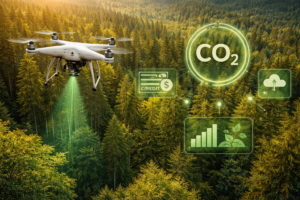
👉 This creates a new revenue stream:
Carbon Credit Economy
💰 Business Models and Revenue Streams
- Drone-as-a-Service (DaaS)
- spraying services
- mapping services
- consulting
- Data-as-a-Service
- crop health reports
- yield data
- carbon reports
- Equipment Sales & Maintenance
- drone sales
- sensor upgrades
- repair services
- Training & Certification
- pilot training
- data analysis training
👉 The real value is not in the drone itself—

but in services and data monetization.
📈 ROI Analysis (Return on Investment)
Example: Precision Spraying (100 hectares)
| Category | Traditional | Drone |
| Chemicals | $8,000 | $4,800 |
| Labor | $2,000 | $500 |
| Equipment | $15,000 | $8,000 |
| Total | $25,000 | $13,300 |
👉 Annual savings: ~$11,700
Drone Seeding Comparison
- Cost reduction: ~76%
- Speed increase: 20x faster
👉 One of the fastest ROI cycles in the drone economy.

⚠️ Regulations and Operational Constraints
Agricultural drone operations are regulated globally.
Key authorities:
Requirements include:
- pilot licensing
- flight permissions
- chemical usage compliance
- insurance obligations
🚀 Future Trends and Industry Outlook
Autonomous Drone Fleets
- multi-drone coordination
- automated battery swapping
- continuous operations
AI Integration
- disease prediction before symptoms
- automated decision-making
- real-time analytics
Carbon Credit Expansion
- verified carbon tracking
- environmental financing
- sustainability reporting
Swarm Technology
- large-scale field operations
- synchronized drone fleets
🎯 Strategic Conclusion
Agricultural drone systems are no longer experimental—they are becoming standard infrastructure in modern farming.
Key takeaways:
- reduce costs
- increase yield
- improve sustainability
- generate data-driven decisions
👉 Agriculture is no longer manual—
it is a data-driven industry powered by drones.
🔗 Navigation
👉 Return to main article:
Drone Economy: Global Use Cases (2026)
👉 Continue:
How to Build an Agricultural Drone Business (2026 Guide) (next)
— Analysis by Gürkan Bal
Founder & Editor | UAV Intelligence